MT Imaging allows us to obtain 1‐D, 2‐D, or 3‐D relative resistivity data to help define the geology, map formation structure, and the formation’s fluid content.
SERVICES
- MT‐1 Geophysical Surveys
- MT‐2D Geophysical Surveys
- Geological Services (*TBD)
- Prospects (*TBD)
MT‐1
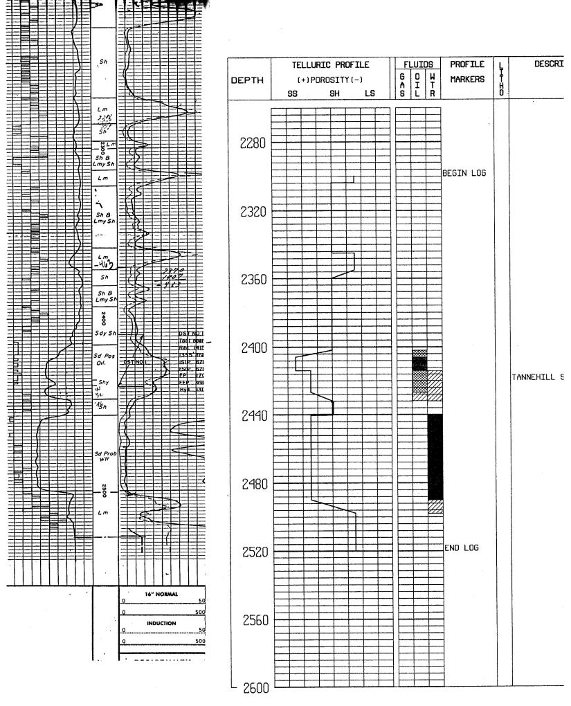
The MT‐1 geophysical survey system was developed in 1990 to successfully determine the geological conditions from ground level to 20,000 feet. The MT‐1 is a field‐portable EM data acquisition system which allows an operator to capture the desired data, store it on a digital medium, and transport the data to our offices for processing. The data is presented in a two‐fold format which provides a T‐Log (telluric curve/apparent resistivity) and a fluid signature at each horizon where porosity and permeability are indicated.
MT-2D
Telluric Technologies is pleased to announce the implementation of the underground resistivity mapping system. Our hybrid‐sourced MT‐2D system is the first portable subsurface resistivity imaging equipment that allows a high two-dimensional resolution view of the subsurface from ground level to approximately 4,500 feet. The data generated is used in a variety of applications where subsurface resistivity measurements are of interest. These include projects seeking to identify oil and gas, formation structure, coal bed methane, seam thickness and structure.

How it Works
Our MT‐2D system operates and images the subsurface by utilizing certain electromagnetic frequency ranges that can penetrate the ground. Many of these frequencies naturally occur in the earth’s electromagnetic envelope. The natural field is primarily sourced by solar activity, thunderstorms, and man made electromagnetic fields from sources such as power lines. We also utilize a transmitter source to provide frequencies needed for depth‐specific shallow investigations. Utilizing these frequencies allows us to continuously image the resistivity values of the formations below, and correlate the corresponding layers in a computer‐generated 2‐Dimensional format. Our geologists are then able to interpret and identify the geological conditions that underlie a property.
